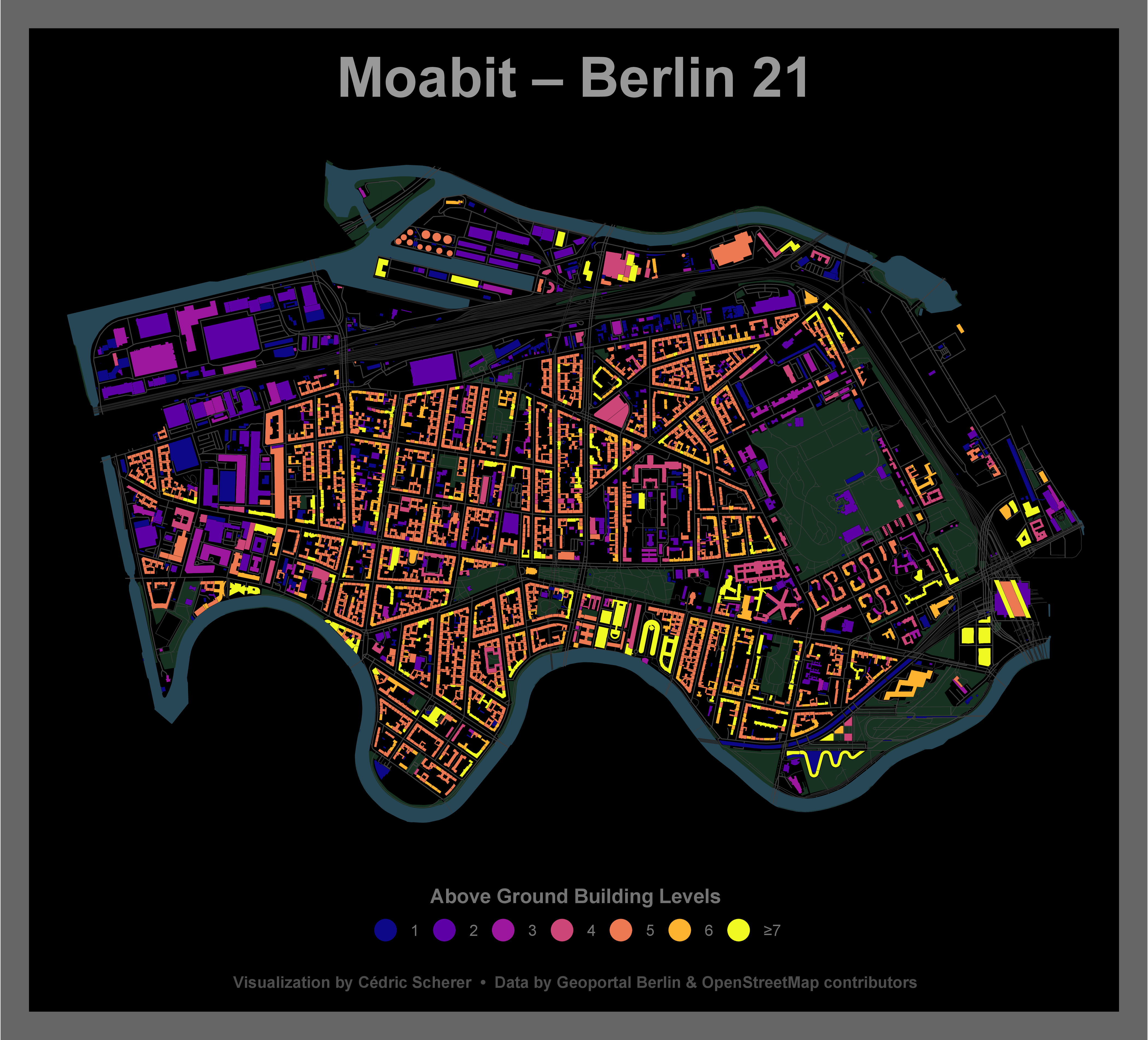
This repository contains the following shapefiles cropped for my home district Moabit in Berlin that is also known as "Berlin 21":
-
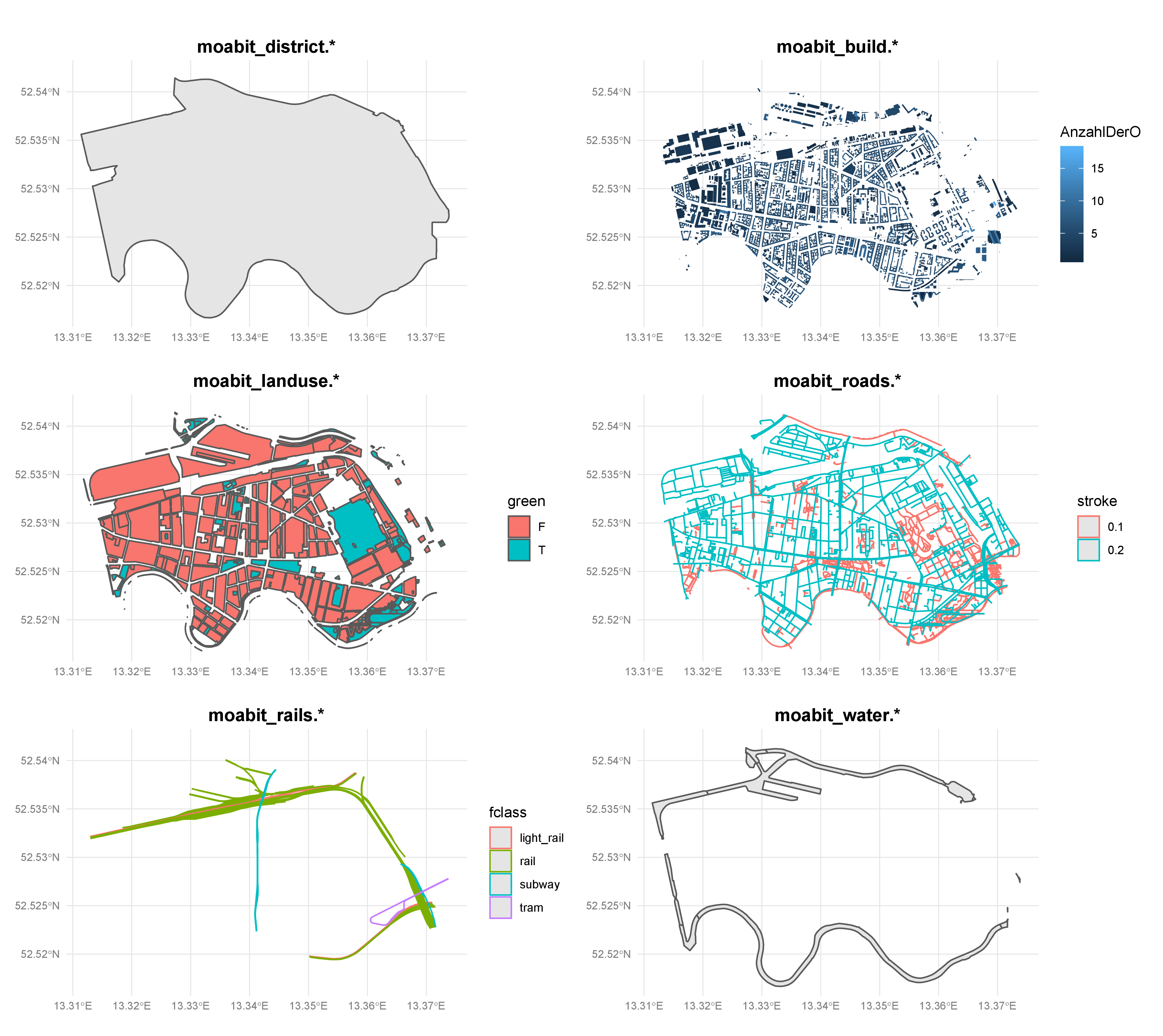
sf_moabit_district.shp: District border of Moabit -
sf_moabit_build.shp: 4056 buildingsOBJECTID: identification numberGebaeudefu: building function numberGebaeude_1: building type (in German)AnzahlDerO: number of above ground levelsAnzahlDerU: number of below ground levelsName: buidling name (in German)
-
sf_moabit_landuse.shp: Landuse classificationosm_id: OSM identification numbercode: 4 digit code defining OSM feature classfclass: OSM feature classname: name of the featuregreen: green space classification, boolean variableTRUEif fclass one of "park", "recreation_ground", "cemetery", "scrub", "forest", "heath", "allotments" or "grass"FALSEotherwise
-
sf_moabit_roads.shp: Road networkosm_id: OSM identification numbercode: 4 digit code defining OSM feature classfclass: OSM feature classname: name of the featureref: reference numbermaxspeed: speed limitoneway: boolean variable,Tif feature is a oneway,Fotherwisebridge: boolean variable,Tif feature is a bridge,Fotherwisetunnel: boolean variable,Tif feature is a tunnel,Fotherwisestroke:0.1in case of "path" and "footway",0.2otherwiselayer: OSM layer
-
sf_moabit_rails.shp: Railway tracksosm_id: OSM identification numbercode: 4 digit code defining OSM feature classfclass: OSM feature classname: name of the feature
-
sf_moabit_water.shp: Water bodiesosm_id: OSM identification numbercode: 4 digit code defining OSM feature classfclass: OSM feature classname: name of the feature
Data sources that have been used:
- District borders ("Ortsteile"): Berlin Open Data; uploaded: 2014-12-31
- Buildings: Geoportal Berlin via ESRI DE Open Data; uploaded: 2019-01-25
- Note:
Gebäude__Berlin.shpandGebäude__Berlin.dbfare not included here due to file size limits
- Note:
- Landuse categories, road network, railsways and water bodies: OpenStreetMap contributors via Geofabrik GmbH; last update: 2019-12-04
Other useful reosurces:
- A collection of (all?!) Berlin's spatial units including districts, district areas, LORs, traffic cells, corridors, and ZIP code areas
- BerlinOpenData for a range of (potentially) interesting data about Berlin